Mapping & Surveying
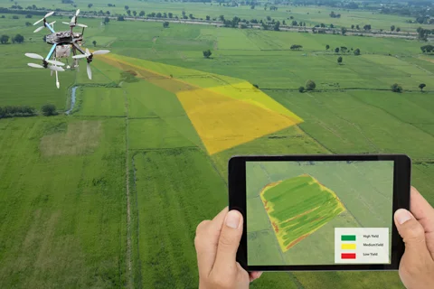
Dive into the future of agriculture with Eagle Aerial Solutions’ Mapping & Surveying services, a game-changer for farmers in Coffs Harbour, NSW. Through our leading-edge drone technology, we create detailed and accurate maps that provide valuable insights into your farm’s operations.
Mapping & Surveying is a crucial services for any farmer. It helps you understand your land better, track changes over time, plan your activities more effectively, and make data-driven decisions.
Traditional methods can be laborious, costly, and imprecise. But with Eagle Aerial Solutions, you can bypass these constraints. Our drone-based Mapping & Surveying services in Coffs Harbour provide a faster, more accurate, and more cost-effective solution.
At Eagle Aerial Solutions, we are all about precision and quality. We utilize advanced imaging technology to capture high-resolution aerial photographs of your farm. These images are then processed to generate comprehensive and accurate maps that reveal important details about your land and crops. With our maps, you can easily identify areas of concern, monitor growth patterns, and plan your interventions more effectively.
Our team is composed of CASA-approved operators who have a deep understanding of farming. We understand that no two farms are the same, so we customize our services to meet your unique needs. Eagle Aerial Solutions is not just a service provider; we are your partners in growth. We believe in building long-term relationships with our clients, and our excellent customer service reflects this commitment.
So, if you’re a farmer in Coffs Harbour and you’re looking for the best Mapping & Surveying services, look no further than Eagle Aerial Solutions. Reach out to us today, and let’s explore how our drone technology can transform your farming operations. Together, let’s cultivate the future.
